

Computed from the terrain
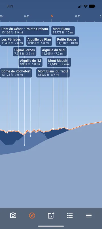
Many peak apps label every summit in a direction, even those hidden behind the mountain in front of you. PeakLook computes the line of sight from the terrain around you. A peak hidden by a closer ridge is not labelled.
The computation includes the Earth's curvature and the refraction of light by the air, which matter for peaks far away.
Barely visible peaks
A peak that barely shows above a ridge is drawn paler. It may be hidden, depending on snow, trees or the exact spot where you stand. Its details say Maybe hidden: the terrain in front almost reaches its summit.
How far, and from how high
- Maximum distance: 20, 50, 100, 150 or 250 km (100 km at first).
- Minimum elevation: hide the smaller summits.
- Number of labels: Few, Normal or Many.
- Eye height: from a viewing platform, a tower or a tall building, the view goes further.
Without terrain data on the phone, the names are approximate and the app says so. See Which peaks are shown.