


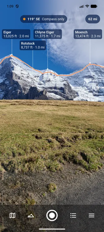
Raise the phone
Hold the phone at eye level and point it at the mountains. Each visible peak gets a label: its name, its elevation and its distance from you. A thin line follows the skyline, so you can check that the labels sit on the right summits.
Labels never overlap. When there is not enough room, the most prominent peaks come first.
Aligned on the landscape
A phone compass can be off by ten degrees or more. PeakLook corrects it: it matches the skyline seen by the camera with the skyline computed from the terrain. A dot at the top of the screen tells you how it is going:
- green: the labels follow the skyline;
- orange, Compass only: only the compass is used;
- red, Compass disturbed: move the phone in a figure 8.
Labels still off? Drag the view with your finger to put them back on the peaks. The dot then says Aligned by hand, and Undo goes back. See Compass and alignment.
Tap to read
Tap a label to open the peak's details. Tap elsewhere to freeze the image and read in peace; tap again to resume. The distance chip at the top changes how far PeakLook looks, from 20 to 250 km, with one tap.