
Name every peak you see
Raise your phone, point it at the mountains: each visible peak gets its name, elevation and distance. Free, no account, offline.

 Scan with your phone to install
Free on Android · No account · Works offline
How it works
- 1
Raise your phone
Point the camera at the mountains, at eye level.
- 2
Read the names
Each visible peak gets its name, elevation and distance.
- 3
Go offline
Download the area around you, then it works in airplane mode.
PeakLook in 16 seconds
 Play the video · 16 s
The video plays on YouTube. Nothing loads from YouTube until you press play.
PeakLook is an Android app that identifies the mountains in front of you. Point the phone's camera at a range: the name, elevation and distance of each visible peak appear on the live image.
A peak finder like PeakLook knows where you stand, which way the phone looks, and the shape of the terrain around you. From these, it works out which summits you can really see, and where they sit in the picture.
- Peak names on the camera — labels on the live image, aligned with the skyline the camera sees. Peak names on the camera
- Only the peaks you can see — a summit hidden behind a closer ridge gets no label. Only the peaks you can see
- Photos with peak names — take one, or annotate a photo you already have. Photos with peak names
- Offline areas — download the area around you, then use it in airplane mode. Offline areas
There is no account and no subscription. Your location stays on your phone. PeakLook covers the whole world, with about 760,000 named peaks from OpenStreetMap.
From the camera to the summit
Camera view
The name, elevation and distance of each visible peak, on the live image.
Visible peaks
A peak hidden behind a closer ridge gets no label.
Drawn view
The skyline and the peaks all around you, without the camera.
View from anywhere
Long-press the map, and PeakLook shows the peaks visible from there.
Peak details
Tap a label for the peak's details, or open the list of visible peaks.
Photos
Take a photo with the names on it, or annotate one you already have.
Offline areas
Download the area around you before you leave. Then everything works without a network.
Privacy
Your location stays on your phone. It is used only to compute the view.
Why PeakLook
- Free: every feature
- No account
- Works offline
- 760,000 peaks worldwide
- 42 languages
- Android 8.0 and later
See it in the app
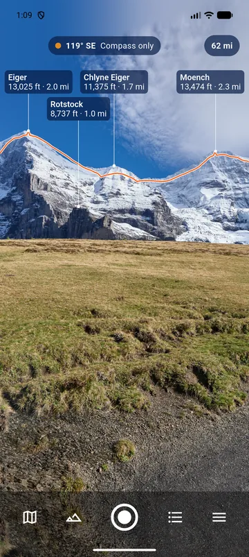
The camera view: Eiger, Mönch and two other peaks named on the image, with elevation and distance
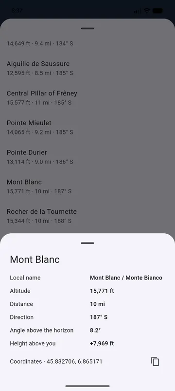
The details of Mont Blanc: elevation, distance, direction, angle above the horizon, height above you, coordinates
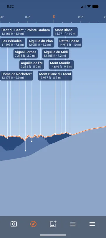
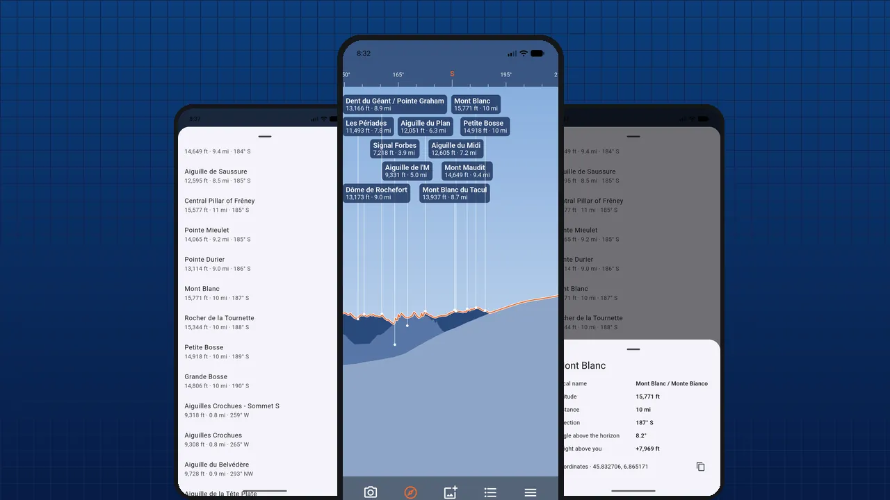
The drawn view: the skyline of the Mont Blanc range and the names of its peaks
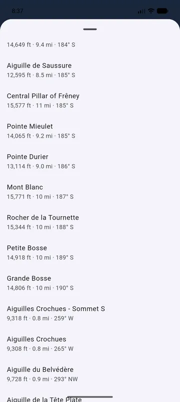
The list of visible peaks, from left to right
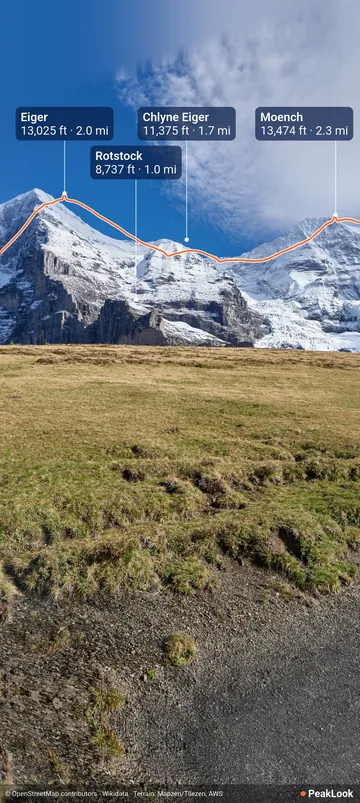
A photo saved with the skyline and the peak names
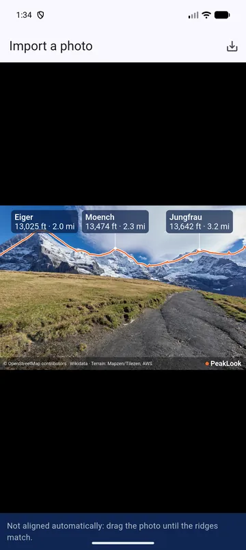
An imported photo, lined up with the ridges by hand
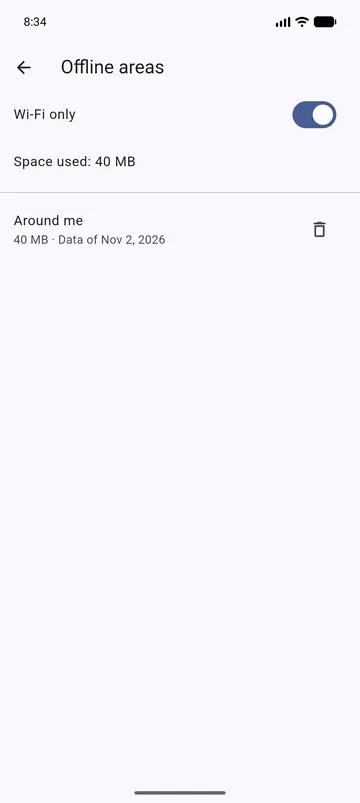
Offline areas: the area around you, 40 MB, Wi-Fi only

Your data stays yours: no account, no subscription
Guides
Identify mountains
Which mountain is that? Your phone can tell you, even far from any network.
Offline peak finder
In the mountains, the network often stops before the view starts.
Names on photos
A panorama is better with names. Two ways to put them on.
How far you can see
Three things decide whether a peak is in sight: the terrain in front, the Earth's curve, and the air.
Compass accuracy
Ten degrees is one peak to the next. Here is how to get it right.


Which peak is that?
Raise your phone and find out. Free, offline, no account.